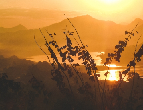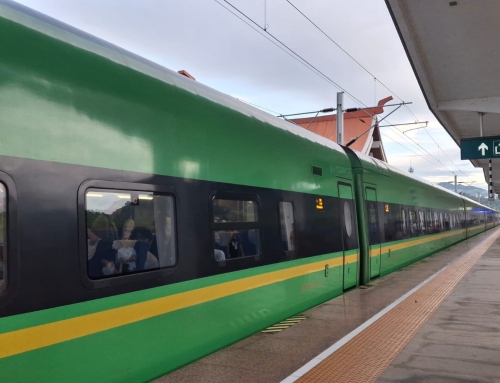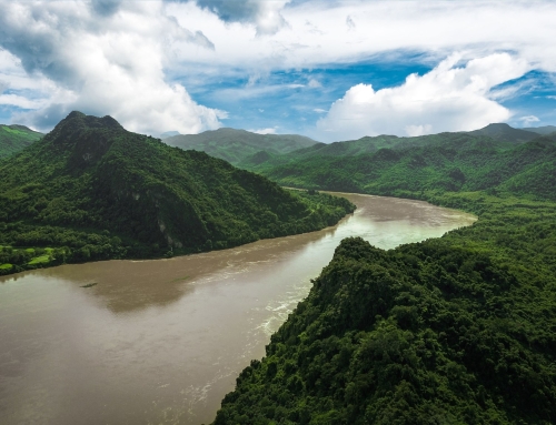

Most travellers drive straight past central Laos. Route 13 runs south from Vientiane towards Savannakhet and the border, and Khammouane province sits quietly to the east of it, an hour off the main road. That hour buys you one of the most dramatic landscapes in the country: vertical limestone cliffs, a lake full of dead trees, and a cave you cross by boat for seven and a half kilometres. And, a few valleys further on, the same rock flown over on a zipline.
The road that links all of this is known as the Thakhek Loop. Here is how it works, when to go, what Kong Lor Cave actually costs, and how we run it for travellers who would rather not spend four days on a scooter seat.
What the Thakhek Loop actually is
A 450-kilometre ring road
Thakhek is a small provincial capital on the Mekong, directly opposite Nakhon Phanom in Thailand. The two banks have been linked since 11 November 2011 by the Third Thai-Lao Friendship Bridge, 780 metres of concrete and two lanes that turned a sleepy river town into a freight corridor between Thailand and Vietnam.
The loop leaves Thakhek heading east on Route 12, climbs north across the Nakai plateau and the town of Lak Sao, drops back down to Ban Na Hin and Kong Lor Cave, then rejoins Route 13 to close the circle. Allow roughly 450 kilometres depending on detours, and four to five days, five if you give The Rock a full day to do it properly. Two days buys you tarmac and not much else.
It is not only for motorbike riders
The loop built its reputation among independent travellers on rented scooters, and it deserves it. But most of the route is now sealed and it drives perfectly well by car with a driver, which changes everything for a couple, a family, or anyone who does not fancy 120 kilometres of rain with a backpack strapped to the rear rack. The scenery is identical from the back seat. You simply stop more often.
Kong Lor Cave: 7.5 kilometres under a mountain
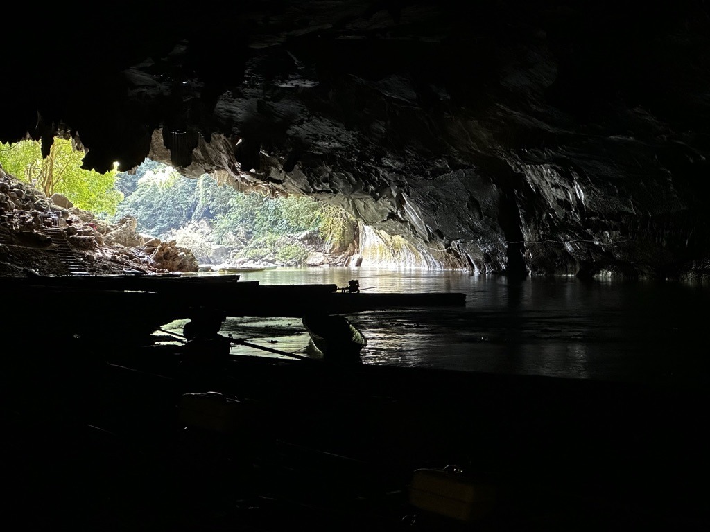
This is the reason people come, and it is one of the few sights in Laos that fully delivers. The Nam Hin Boun river disappears beneath a limestone massif inside Phou Hin Boun National Protected Area and comes out 7.5 kilometres later on the far side of the mountain. You cross that natural tunnel in a long-tail boat carrying three passengers and a boatman.
What the crossing is like
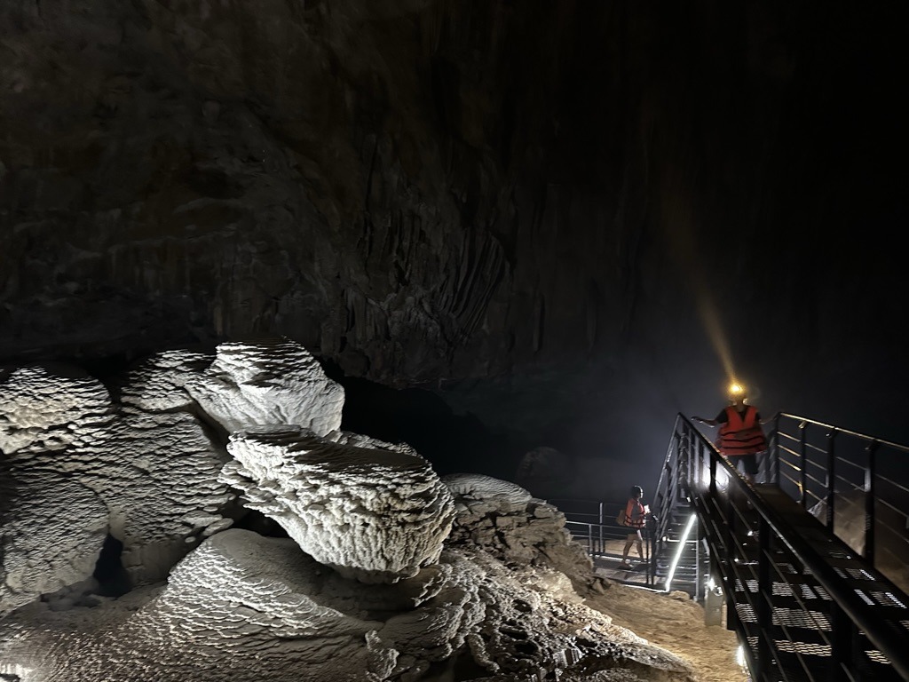
It is dark, properly dark, and cool. The boatman works upstream by headlamp, cuts the engine in the narrow sections and poles through when he has to. One chamber along the way is lit, bristling with formations, and you get out and walk through it. When the water is low the hull touches bottom: everyone steps out, wades a few metres and climbs back in. That is part of the trip, not a problem with it.
Daylight returns abruptly on the far side, over a village and its fields. You rest there before making the return crossing. Budget about an hour of boat time each way, and half a day in total.
Costs and practicalities
- Around 200,000 to 250,000 kip per person (2026 rates), including the park and cave entrance fees. The boat is shared between three, so travelling alone costs more. Rates shift from season to season, so confirm on site.
- Bring your own headlamp. One is provided, but it will not match yours.
- Dry bag and shoes you can soak. Boat floors are wet and you will occasionally walk in the river.
- A light fleece. It is noticeably colder inside the mountain than outside it.
- Sleep the night before at The Rock Lodge, Ban Na Hin or Ban Na Hin the night before and go in early, ahead of the day groups arriving from Vientiane.
The Rock: the stone forest from above
Kong Lor is met from below. The same massif can also be met from above, and it is almost more impressive.
On the northern section of the loop, at Phou Pha Marn, a viewpoint looks down on what is known here as the stone forest: thousands of limestone spires standing more than 400 metres above the valleys, inside the same Phou Hin Boun protected area as the cave. The site was opened in 2019 by the Inthira group and has become, in a few seasons, the busiest attraction in Khammouane. They call it the peak of the loop.
Going up just for the view
You do not have to clip into a cable. The viewpoint alone, with its information centre and the Khop Chai Deu restaurant, costs around 50,000 kip. They serve what many rate as the best coffee in the province, facing the karsts. It is an hour of your time, and it already earns the detour.
With a little patience you may spot the Laotian langur, an endangered monkey found nowhere else, whose troop of about twenty ranges around the area on a circuit of roughly four days.
Giving it a full day
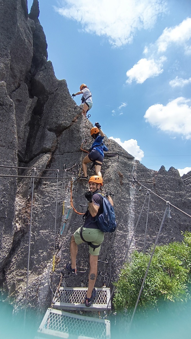
The Rock Challenge, the full-day version, is one of the finest adventure days in Southeast Asia, and almost nobody writes about it. Around fifteen ziplines, more than four kilometres of cable in total — starting with one of 480 metres. A via ferrata up to a 360-degree viewpoint. The only spider net bridge in Laos, 62 metres long at 440 metres of altitude, plus three more suspended bridges. A 30-metre abseil down a cliff. Two kilometres of walking through the canopy, and a 50-metre cave full of bats. Reckon on USD 100 for the day, English-speaking guide, lunch box, government taxes and entrance fees included.
The short version, for those without a full day: Highlights of the Rock, about two hours and USD 30, which keeps the essentials — the long opening zipline, the via ferrata and the spider net.
What to know before you book
It is not an athlete’s test: ordinary fitness is enough and the site suits families. But everything happens high above the ground and the rules are not negotiable — closed shoes are mandatory, minimum height 1.20 m, maximum weight 120 kg. There is very little shade on the rocks: sunscreen, long sleeves, refillable bottle. And secure your phone, the valley is a long way down.
Book ahead at weekends and during Lao holidays: the site is very popular with Lao visitors themselves.
When to go, and when to skip it
The window is the dry season, November to March. Roads are dry, the river level is comfortable and the cliffs are clear of haze. December and January are the most pleasant months, with genuinely cold mornings up on the Nakai plateau.
By March and April the water drops. The crossing is still possible but you will be getting out of the boat more often. During the rainy season, May to October, the cave usually stays open but can close after heavy rain until the level falls again. We never promise it at that time of year, and it is also when the unsealed sections of the loop turn difficult.
To place your dates across the whole country, our guide to the best time to visit Laos breaks the question down region by region.
The route, day by day
Day 1: Thakhek and the Route 12 caves
You leave Thakhek heading east and the cliffs close in almost immediately. The first stretch holds several easily accessible caves: Tham Nang Aen, lit and laid out for walking, and Tham Pa Fa, the Buddha Cave, a hillside shrine that has become a place of pilgrimage. Modest dress required, shoulders and knees covered. The day is deliberately short. It is there to ease you into the landscape.
Day 2: the Nakai plateau and the drowned forest
The road climbs onto the Nakai plateau and opens onto the strangest sight of the loop: a vast sheet of water with thousands of grey trunks standing in it. This is not a natural lake. It is the reservoir of the Nam Theun 2 hydropower dam, which flooded the plateau and its forest in the mid-2000s. You may find it beautiful, you may find it brutal. It is above all a useful reminder of what electricity costs a country that sells its power to its neighbours.
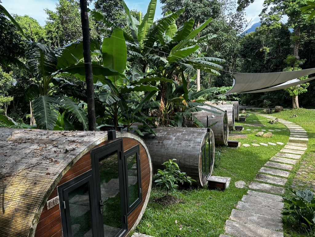
Lunch at Lak Sao, a charmless but well-placed border town, then south on Route 8, the road that runs on towards Vietnam. Night at The Rock Lodge, at the foot of the stone forest.
Day 3: the stone forest, in the air
A full day at Phou Pha Marn. An early start from the visitor centre, harness, briefing, and the first 480-metre zipline across the valley. It is the longest one and it comes first, which settles the question of vertigo straight away.
The rest follows without a dull moment. Via ferrata up to the 360-degree viewpoint, suspended bridges, the spider net at 440 metres, a 30-metre abseil, stretches of walking through the canopy, a cave to cross on foot. Lunch on the way, or at the Khop Chai Deu on the way back, the stone forest in front of you.
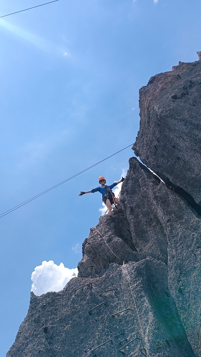
Those who do not fly are not wasting their day: the viewpoint, the information centre and the restaurant terrace easily fill an afternoon, and that is where you have the best chance of seeing the langurs.
Second night at The Rock Lodge, on Route 8.
Day 4: Kong Lor
Leave at first light. About fifty kilometres, the last of them along a corridor of rice fields wedged between two walls of limestone: one of the finest arrivals in Laos, and one of the few where you resent having windows. You reach the landing stage before the day groups from Vientiane. The crossing and the way back take half a day. Having flown over the rock the day before, you now pass underneath it: it is the same massif, and that is the best way to understand it.
Day 5: back to Thakhek, or north to Vientiane
Two options. Close the loop south on Route 13 and reach Thakhek by evening, which sets you up to continue to Savannakhet and its colonial shophouses and then the deep south. Or head north to Vientiane, five to six hours away. The choice depends on the rest of your trip, not on the loop itself.
Five things we tell our travellers
- Do not compress it. Four full days is the minimum, five is the right pace if you want the full day at The Rock.
- Carry cash in kip. ATMs are scarce once you leave Thakhek and Lak Sao, and cards are accepted almost nowhere.
- Book your nights in high season. At The Rock Lodge as at Kong Lor, decent beds are few and they go quickly between December and February.
- Leave slack on cave day. A short closure after a storm does happen.
- With only three days, forget the full loop and do a return trip from Vientiane to Kong Lor. You get the cave, you miss the plateau, and that is an honest trade.
Where Kong Lor fits into a trip to Laos
Khammouane has one flaw and one virtue: it is in the middle. The flaw is that you cannot visit it as a side trip from Luang Prabang. The virtue is that it slots neatly into any overland journey up or down the country.
That is exactly what our From the South to Vientiane by Road, 11 days itinerary does, linking the 4000 Islands and the Bolaven Plateau to the capital by way of Kong Lor. For more active travellers, Southern Laos in Sports Mode, 15 days adds kayaking, cycling and walking around the same karst country.
In both cases the cave is a stage of the journey rather than a day excursion: you sleep below the mountain and enter the water early.
Frequently asked questions
How long does the Thakhek Loop take?
Four to five days. Four full days is the realistic minimum if you want Kong Lor and a full day at The Rock; five is comfortable.
Can you do the Thakhek Loop without a motorbike?
Yes. The route is largely sealed and works well by private car with a driver, which is how we arrange it for most of our travellers.
Is Kong Lor Cave worth the detour?
If you have the days for it, yes. A 7.5-kilometre boat ride through a river cave has no equivalent elsewhere in Laos. If your trip is under two weeks and already includes Luang Prabang and the south, it is usually the first thing to cut.
Talk to us
We are a local agency based in Vientiane and we send travellers to Kong Lor throughout the dry season. If you want to know whether this region fits your itinerary, and on which dates, get in touch. We reply within 24 working hours with a costed proposal and no obligation.